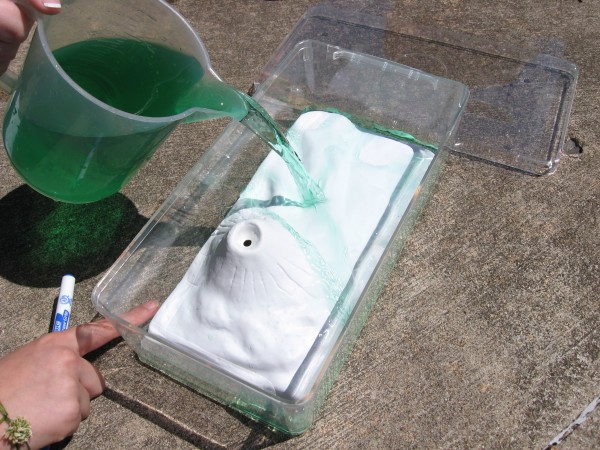
 Today we continued our conversations about topographic maps as we used water and mountain replicas to help us further our knowledge of how they work. Students were given clear plastic boxes with a replica of a mountain in it. They were asked to add green water to their clear tubs in 1 inch intervals and observe how the water raises on the mountains.
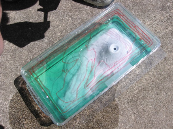
 Once students had water in their box, they would then take a piece of transparency paper and place it on top of the plastic box and outline the water line. The group of students would continue filling up their container with water and outlining the on their transparency up to 9 times.
The big idea behind all of this is to give them an idea of how contour lines on a topographic map work. As you can see from the picture above, this group has several sets of lines on their transparency which show the elevation of the water each time they would pour more water into their container. Tomorrow we will shift our focus as we begin to discuss townships and ranges.
Mr. McClung


I’ve been trying to find these models online to purchase them for my classroom! Do you know where to find them, or the official name for them? All I’ve been able to find when I search for them is your blog!! Thanks from Ms. Saunders